Study Finds Coastal Sea Levels Underestimated, Raising Risk Estimates
Nature study finds about 90% of 385 studies underestimated coastal water heights by roughly 24–30 cm, potentially exposing up to 37% more land and 77–132 million extra people.
 PBS NewsHour
Study finds sea levels are higher than we thought, placing millions more at risk

 New York Post
Tens of millions more may be at risk amid rising sea levels, study finds
 ABC News
The sea is higher than we thought and millions more are at risk, study finds

 Vox
VoxScientists have been underestimating sea levels — for decades
Overview
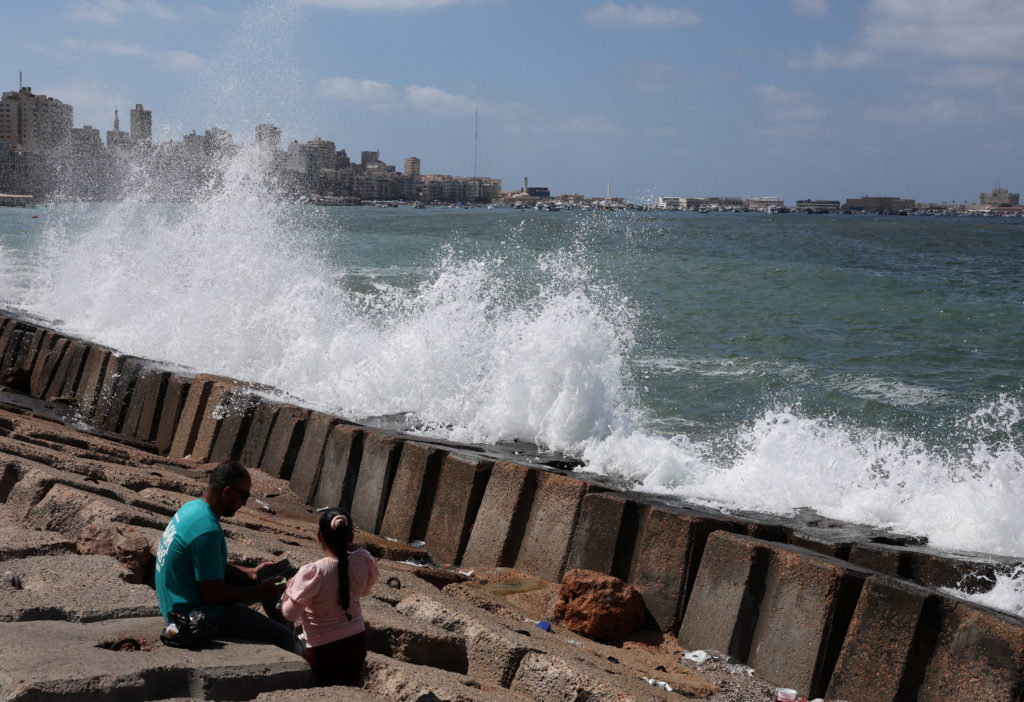
A study published Wednesday in the journal Nature found roughly 90% of 385 peer-reviewed assessments underestimated baseline coastal water heights by about 24 to 30 centimeters, the authors said.
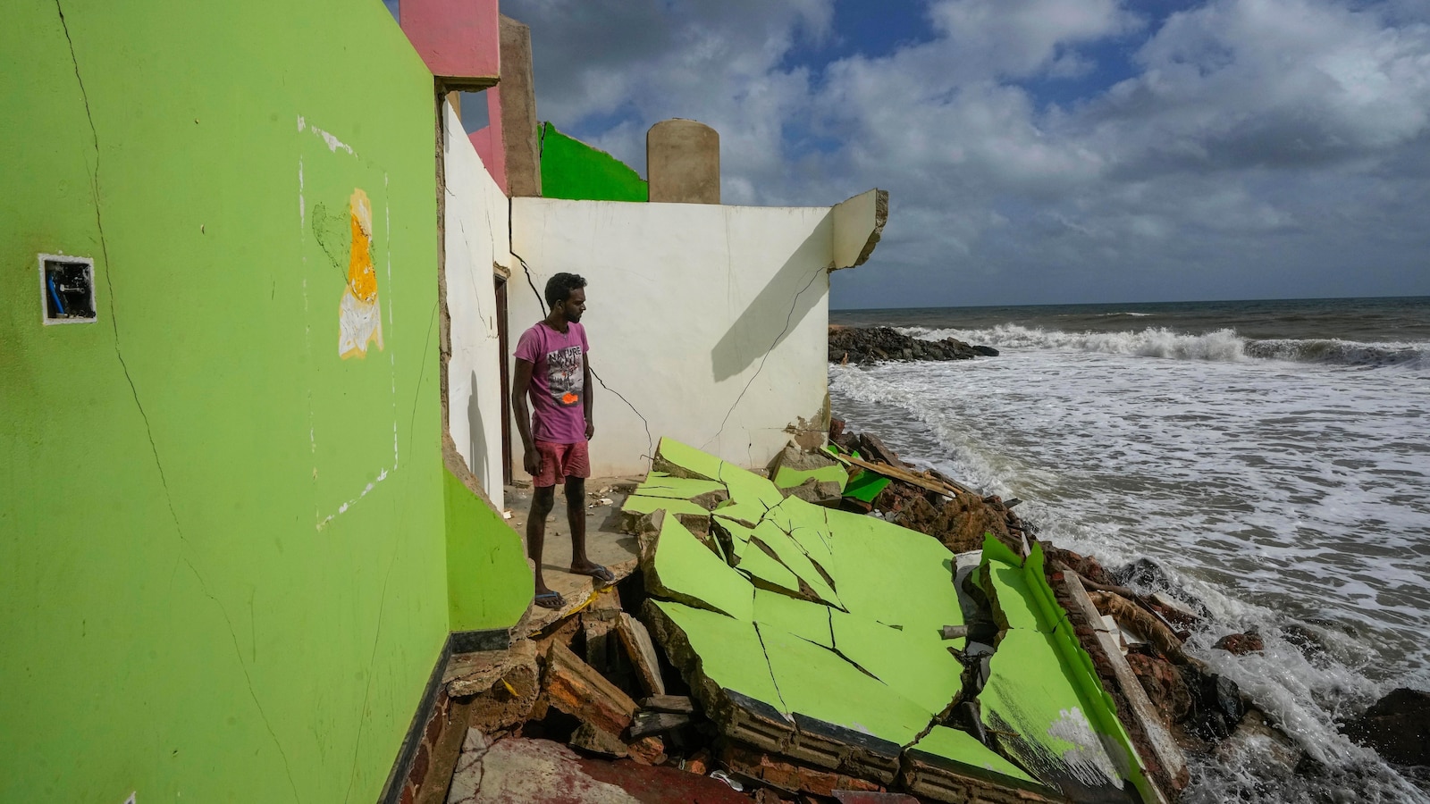
The authors calculated that if sea level rises by about 1 meter, waters could inundate up to 37% more land and threaten roughly 77 million to 132 million additional people, the study said.
Study co-author Philip Minderhoud said the discrepancy stems from a methodological blind spot between sea and land altitude measurements, while outside scientists both warned impacts may be underestimated and cautioned some implications could be overstated, the reports said.
The mismatch was far more frequent in the Global South, especially the Pacific and Southeast Asia where discrepancies reached about 1 meter, and was smaller in Europe and along Atlantic coasts, the paper said.
The authors provided ready-to-use coastal elevation data and called for re-evaluation of coastal hazard methodologies and further work to reassess global sea levels and planning, the study said.
Analysis
Center-leaning sources present this coverage neutrally: they attribute key claims to study authors, include critical outside scientists offering caveats, provide quantitative findings and regional context, and add human-impact testimony to illustrate consequences—demonstrating balanced source selection and cautious language rather than heavy editorializing.
FAQ
The study found that 90% of 385 peer-reviewed assessments underestimated coastal water heights by 24-30 cm on average, with larger discrepancies in the Global South.
Up to 37% more land could be inundated, threatening 77-132 million additional people globally.
Most studies used gravitational models (geoids) that account only for gravity and Earth rotation, ignoring local factors like tides, currents, and winds, or had errors in combining land and sea measurements.
Discrepancies were far larger in the Global South, especially Southeast Asia and the South Pacific, reaching up to 1 meter or more, compared to smaller ones in Europe and Atlantic coasts.
Re-evaluate coastal hazard methodologies, use provided coastal elevation data, and update global sea level assessments and adaptation planning.
